
MAP 2026
Map Analysis
Geographical features, boundaries and location details of Ramapuram Grama Panchayat
Ramapuram Grama Panchayat is an important local self-government institution located in Meenachil Taluk of Kottayam District and within the administrative jurisdiction of Uzhavoor Block. Geographically, it is a beautiful region situated in an area that connects the highland and lowland landscapes of Kerala.
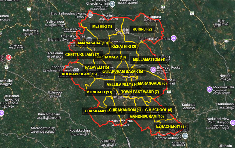
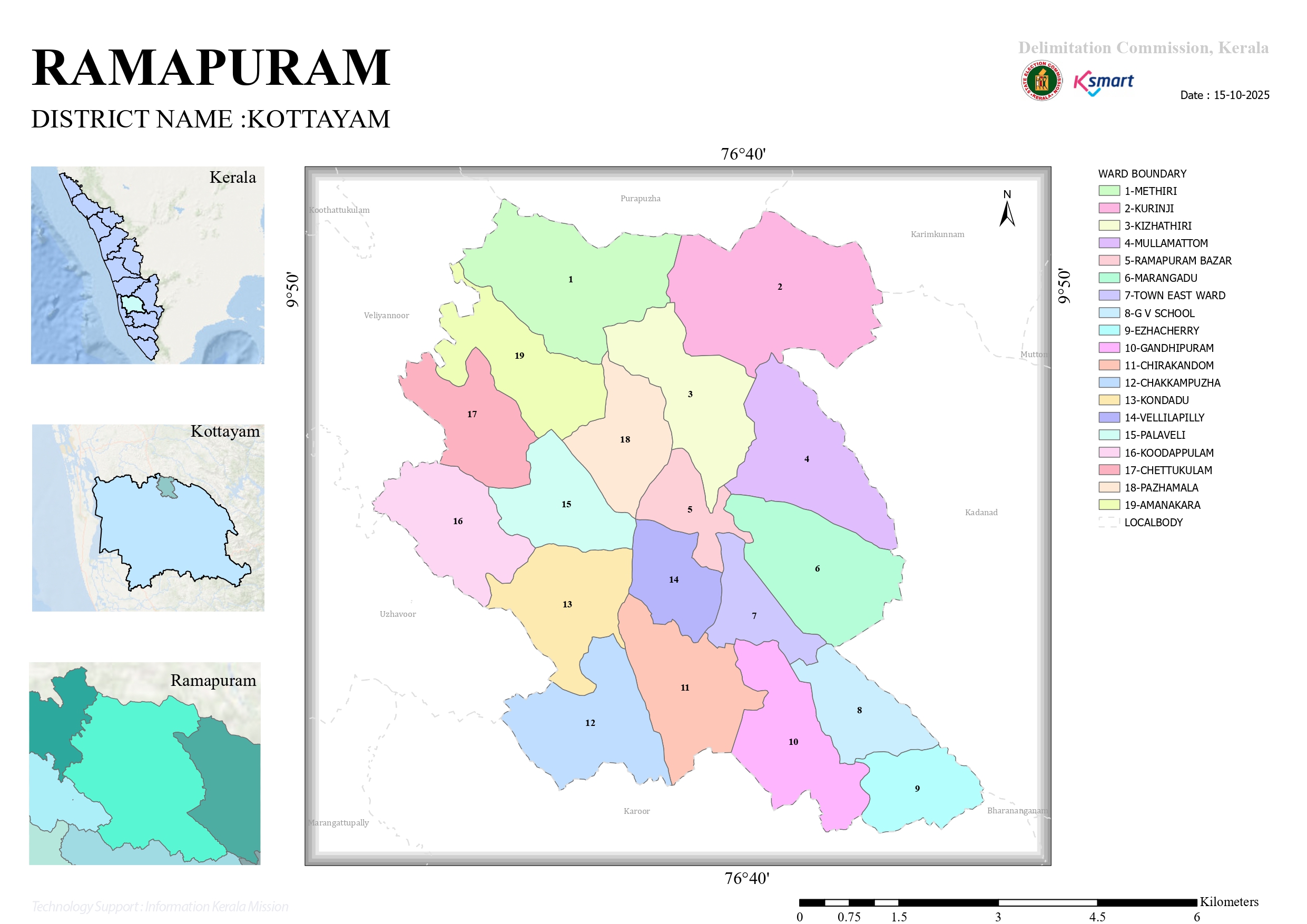
The map of Ramapuram Grama Panchayat provides a clear understanding of its geographical location, surrounding local bodies, boundaries and overall territorial extent.
Key Location Information
Boundaries
The boundaries of Ramapuram Grama Panchayat can be understood from the map and its surrounding local administrative areas.
North
Shares its boundary with Koothattukulam Municipality in Ernakulam District and Purapuzha Grama Panchayat in Idukki District.
East
Bordered by Karimkunnam Grama Panchayat and Melukavu Grama Panchayat in Idukki District.
South
Bordered by Pala Municipality, Bharananganam Grama Panchayat and Kadanad Grama Panchayat.
West
Shares its western boundary with Marangattupilly Grama Panchayat and Veliyannoor Grama Panchayat.
Location & Area
The total geographical area of Ramapuram Grama Panchayat is approximately 54.54 square kilometres.
Longitude: 76.6600° E
Ramapuram's geographical setting brings together the natural characteristics of both highland and lowland regions, making the area distinctive in terms of landscape and location.
Conclusion
The map of Ramapuram Grama Panchayat provides a clear overview of its geographical features, administrative boundaries and relationship with the surrounding local bodies. Located in Meenachil Taluk of Kottayam District, Ramapuram is a notable region characterized by a diverse geographical landscape and its connection with the surrounding areas.